Assess Sites.
Screen for flood risk, nutrient neutrality, biodiversity net gain, and environmental constraints before you commit capital.
A stranded asset costs more than an assessment you skipped.
A site that triggers nutrient neutrality obligations, sits in Flood Zone 3, or sits on contaminated land after acquisition is a stranded asset. The cost isn't the assessment you didn't commission, it's the capital you committed without one.
Since February 2024 every major planning application in England requires a measurable 10% biodiversity net gain. NSIPs, including energy generation and transmission, from November 2026. Most developers still treat these as back-end planning conditions, not front-end acquisition filters.
The information exists. We analyse it before you write the cheque.
Location is the constraint.
BNG, nutrient neutrality, flood risk and EIA are all spatially defined obligations. Whether a site is caught by nutrient neutrality depends on its location within one of 27 sensitive catchments across 74 local planning authorities. The LNRS strategic significance multiplier is entirely location-dependent. None of these constraints show up in a standard legal pack; they require geospatial analysis.
A site intelligence report.
Structured around your specific decision — acquisition, planning application, or investment appraisal.
Front-page summary of what the spatial evidence means for your decision, in language a board can act on.
Specific, prioritised actions tied to the evidence. What to do, in what order, and what to watch.
Intelligence Probability Yardstick applied to give you the confidence in your decision making.
Multi-layer spatial analysis: UKHab baseline, flood, nutrient catchment, designated sites, access and infrastructure context.
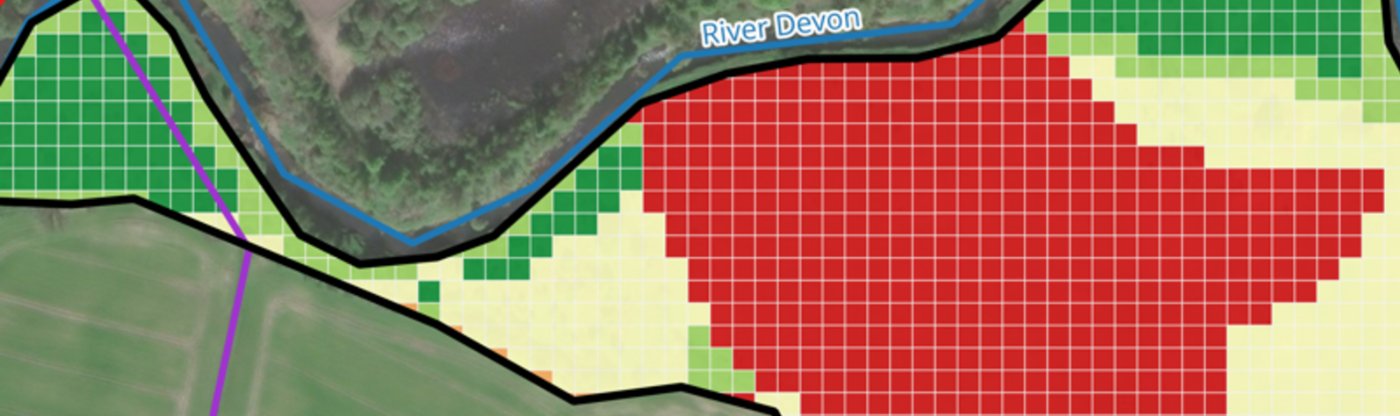
Woodland creation suitability — multi-layer framework.
Terrain and slope analysis, soil constraints, flood persistence modelling, peatland avoidance, and proximity to existing woodland — translated into clear investment guidance. Viable corridors identified; regulatory and ecological conflict zones excluded.
Want to screen a site before you commit?
Send us a postcode and we'll scope a Rapid Site Screen.
Get in touch →Questions we get asked.
A BNG assessment measures the baseline habitat value of a site using the statutory Biodiversity Metric 4.0 and UKHab classification. Since February 2024 all major planning applications in England must demonstrate a measurable 10% net gain in biodiversity, maintained for a minimum of 30 years.
An FRA is required for all development in Flood Zones 2 and 3, and for sites over 1 hectare in Flood Zone 1. The assessment must demonstrate the development will be safe for its lifetime, will not increase flood risk elsewhere, and incorporates sustainable drainage (SuDS) where appropriate.
Nutrient neutrality applies to new residential development in 27 river catchments across England where protected habitats are in unfavourable condition. Whether your site is affected depends entirely on location — 74 local planning authorities are currently affected.
At minimum: flood risk assessment, BNG baseline with habitat survey, and environmental constraints review. Sites in nutrient-sensitive catchments also need a nutrient neutrality assessment. A pre-acquisition screen identifies which of these apply before you commit capital.
We synthesise multiple geospatial datasets into a single decision-grade assessment with explicit confidence ratings. We don't conduct protected species or Phase 1 habitat surveys — we complement ecological consultants by providing a baseline BNG estimate, identifying nature corridors and enabling remote monitoring of site to demonstrate 30 year compliance.
Ready to see what location intelligence reveals about your sites, operations, or portfolio?
Send us a postcode, a bid reference, a framework you're reporting against — or just a sketch of the problem. We'll scope the spatial evidence from there.