Evidence Reporting.
Evidence for UK Sustainability Reporting Standards (UK SRS), Carbon Reduction Plans (CRP), Energy Saving Opportunity Scheme (ESOS), Biodiversity Net Gain (BNG) and Taskforce for Nature-related Financial Disclosures (TNFD).
Frameworks no longer ask whether you have a policy.
They ask whether you can prove it. UK SRS S2 — mandatory for listed companies from January 2027 — requires climate scenario analysis grounded in physical risk data. S1 will follow for other sustainability issues. TNFD's LEAP framework starts with Locate. Meeting these standards and frameworks credibly requires you to report on your sites and facilities.
CRP and ESOS demand reductions in emissions and energy use. This requires an understanding of current operations with sites, supply chains and logistics all critical parts of the puzzle. Plans need to be evidenced with credible data that shows how mitigations can deliver impact.
Every framework now has a spatial dimension.
UK SRS S2 requires physical climate risk assessment — flooding, heat stress, water scarcity, subsidence — inherently site-specific. TNFD's Locate step is a geospatial exercise by definition. BNG reporting under the Environment Act requires spatially referenced habitat baselines.
The evidence that underpins credible reporting isn't found in spreadsheets. It's found in the spatial relationship between your assets, your operations, and the environmental and social context they sit in. Everything happens somewhere.
The evidence layer your disclosures need.
Structured to align with the specific framework(s) you're reporting against — UK SRS S1 and S2, TNFD LEAP, PPN 006, or BNG.
What the spatial evidence says about your climate risk exposure, nature interface, or environmental performance in plain language.
Where the evidence is strong, where it needs strengthening, what mitigations to apply and what spatial monitoring would improve future reporting cycles.
PHIA Yardstick applied to every assessment — an explicit confidence layer most competitors and internal teams cannot provide.
Site- and portfolio-level analysis covering physical climate risk (UK SRS S2), nature dependencies (TNFD LEAP), emissions geography (ESOS), biodiversity baselines (BNG).
Cheshire Wildlife Trust

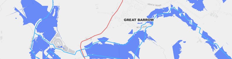
LiDAR-derived terrain modelling — river catchment.
Floodplain connectivity, soil drainage characteristics, land-cover influence on runoff, infrastructure exposure overlays. Where floodwater can be safely retained, slowed, or redirected to reduce downstream risk.
What does your reporting need to evidence?
Tell us which frameworks you're reporting against and we'll scope the spatial evidence you need.
Get in touch →Questions we get asked.
UK SRS S2 requires climate-related disclosures covering governance, strategy, risk management and metrics. The spatial element is strongest in scenario analysis — organisations must assess flooding, heat stress, water scarcity and subsidence across operations and value chain. For multi-site organisations, this requires site-level physical risk assessment using geospatial data.
TNFD uses the LEAP approach: Locate, Evaluate, Assess, Prepare. The Locate step requires organisations to map where they interface with nature across operations, assets and supply chains — identifying which sites sit near protected habitats, water-stressed catchments or biodiversity-sensitive areas.
SECR requires large UK companies to disclose energy use, Scope 1 and 2 carbon emissions and an energy intensity metric. UK SRS goes significantly further — climate scenario analysis, governance disclosures, climate-related risks and opportunities. Both require site-level data for multi-site organisations.
Greenwashing risk arises when claims cannot be substantiated. MapHorizon reduces this risk by providing spatially referenced, reproducible analysis with explicit PHIA confidence ratings. Every claim can be traced back to its spatial data source, methodology and confidence level.
Ready to see what location intelligence reveals about your sites, operations, or portfolio?
Send us a postcode, a bid reference, a framework you're reporting against — or just a sketch of the problem. We'll scope the spatial evidence from there.